| Charlie Toledo, Executive Director |
Even though many of us in Northern California will be receiving more rain this week, California continues to be in dire straights water wise. We must change our ways! We have built large cities in deserts, cities dependent on rivers that are dying largely due to our mismanagement and lack of understanding. Communities are running out of water, and our interventions stand to make things worse.
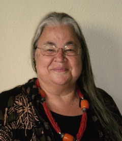
Charlie Toledo, Executive Director of the Suscol Intertribal Council in Napa, CA, spoke with me last week about the drought and the water situation in California. She helped author the Watershed Development plan for Napa County in its seminal years, 1992-1995, and more recently serves on the State Low Income Oversight Board, a committee of the California Public Utilities Commission. For more than 30 years, she has served as peace activist, community organizer, and healer, dedicated to preserving Native American culture and building the cohesiveness of indigenous groups in the Napa area.
A current project at Suscol Intertribal Council, a 501(c)3 organization, focuses on building “Suskol House”, a spiritual center for Native American peoples in Pope Valley. The construction begins in April, 2014. If you appreciate the work of Charlie Toledo in developing a healthy relationship to our waterways informed by native wisdom and current science, please consider making a tax deductible donation to the building of this unique structure, a model for use of materials and sustainability. For more info and to make your donation, watch this video.
Drought Interviews: Charlie Toledo, Part One: Watersheds in Napa County
Patricia: Charlie, would you tell us about your work with the watershed in Napa County?
Charlie: It’s been mostly peripheral. I was working with Watershed Development around 1992-1993, initially around flood control. The Army Corps of Engineers wanted to cement the whole river and make it be like the L.A. River and so the Friends of the River, headed by Judith Sears, was really fighting against that. She actually won that argument and they did what became a watershed evaluation plan.
It was a three year plan, like I said, started around 1992-93. That would have been thru about 95-96. We were working with all the county supervisors, all the mayors, all of the environmental groups, of which at that time there were a very few. That was the formation of Friends of the River. (Suscol Intertribal Council had just reformed in 1992.) We had monthly meetings and basically came up with a watershed plan that did not involve cement in the waterway. That became the groundwork for what we called watershed management. What they decided was sexier and had a little bit more marketing value. They called it flood control.
We said flood control was a misnomer; because, when it’s flooding it’s not in control. I was the spokesperson representing Suscol Intertribal Council. Just like we said earlier, I was bringing up points that nobody else was bringing up. I was bringing up the point of riparian corridor. I was bringing up the point of the vineyards. Many vineyards are running their lines perpendicular to the river so they create erosion paths directly into river and waterways. The riparian corridor was the biggest thing that was being ignored. At the end of that watershed plan there was supposed to be a 12 foot riparian corridor. I said 12 feet wasn’t really enough. I was really pushing for 21 foot, which meant along the whole length of the Napa River all the way both sides of the Napa River from southern end below Napa College north to Calistoga.
Patricia: What do you mean by riparian corridor?
Charlie: That’s the trees and bushes that grow along the river that hold and stabilize the bank. Even if the river floods, the bank still holds. Without a riparian corridor what happens is the banks erode. That’s what’s happening in Napa Valley now.
Initially it was going to be a 21 foot corridor. At the end of that plan in 95-96, it was going to be 12 foot. Really, that riparian corridor didn’t get put into the plan at all. There’s big hunks of Napa Valley going into the river every flood at the rate of six to seven feet a year. That was the pre-stage of the Resource Conservation District, which is a federal agency based in every county, but the one here in Napa County coordinated the development of this watershed plan.
They actually created “support groups” for every watershed. Then they went to identify the residents and people that lived in those watersheds and that is still a collective action—a lot like a neighborhood watch, only it’s a watershed watch. The people meet annually. That model of public input, working in a public forum for years, developing and then implementing the plan, has become a national model. Napa actually established that model.
There were ideas that I had about Napa Creek, because, I was living on Napa Creek. It had flooded seven times in ten years. The plan that they’ve implemented is actually my ideas, at that early planning stage.
Of course, when it got to implementation, I was long gone and the scientists and engineers came in. Unfortunately, when the public went away, what the city did was what they said they weren’t going to do: they let the riparian corridor get down to 12 feet, and in some places, two feet. I said, “Two feet is not a riparian corridor! That’s one tree! That’s not even the canopy of one tree.” This is one of our big mistakes in Napa County and the world: not honoring that riparian corridor.
What some counties like Monterey County are doing, is to go too far the other way. They’ve left the riparian corridor, the bushes and trees, but you can’t touch them. That’s again imagining that in pre-European time, it was a wilderness, but it wasn’t a wilderness. It was a managed agricultural base, managed by indigenous peoples.
Patricia: How did they manage the trees and plants?
Charlie: What native people did was leave the big trees and hardwood trees. The riparian corridor would have been very intact. The willow would be harvested annually. The sedge would be harvested annually, which means it would trimmed and cut back. It wouldn’t get all tangled and overgrown. The blackberries would be harvested and picked. The sedges and the real big perennial grasses would be burnt through every three years so there wouldn’t be all the brush and buildup. The burns reduced mice, ticks and mosquitoes. A person and wildlife could access the banks of the river.
When you do like Monterey County has done, leave it, even the wild animals can’t get to the water, because, it’s all overgrown. It’s all entangled. The blackberries, the willow, the trees and the brush get all entangled and become inaccessible and usually start clogging up the waterway.